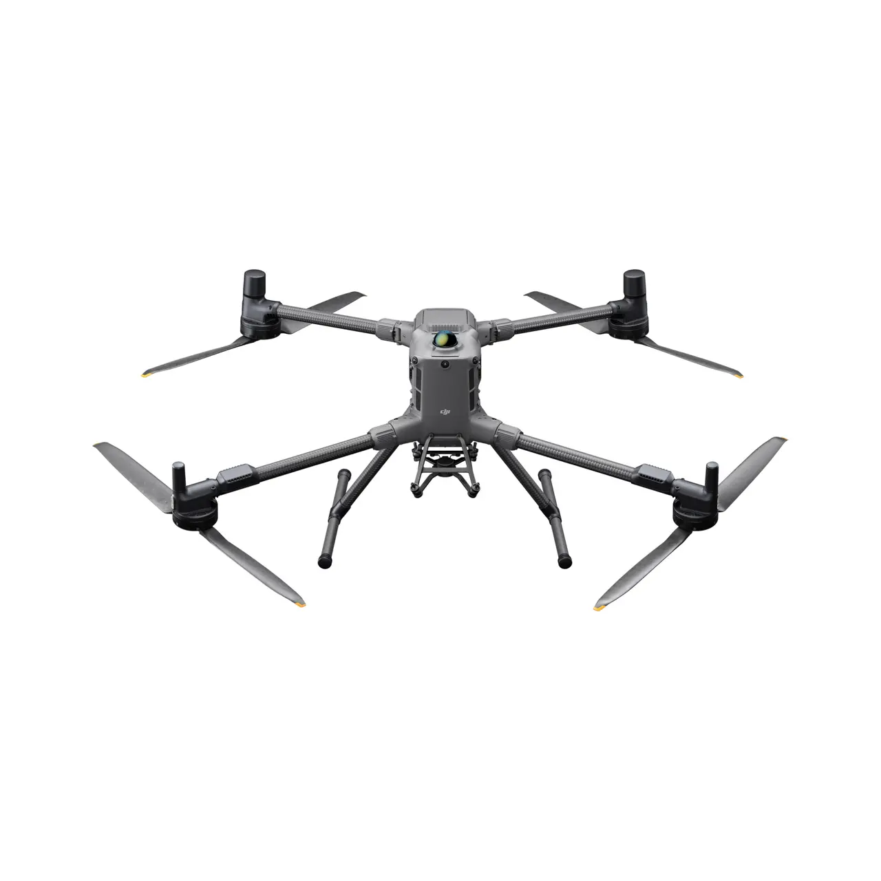
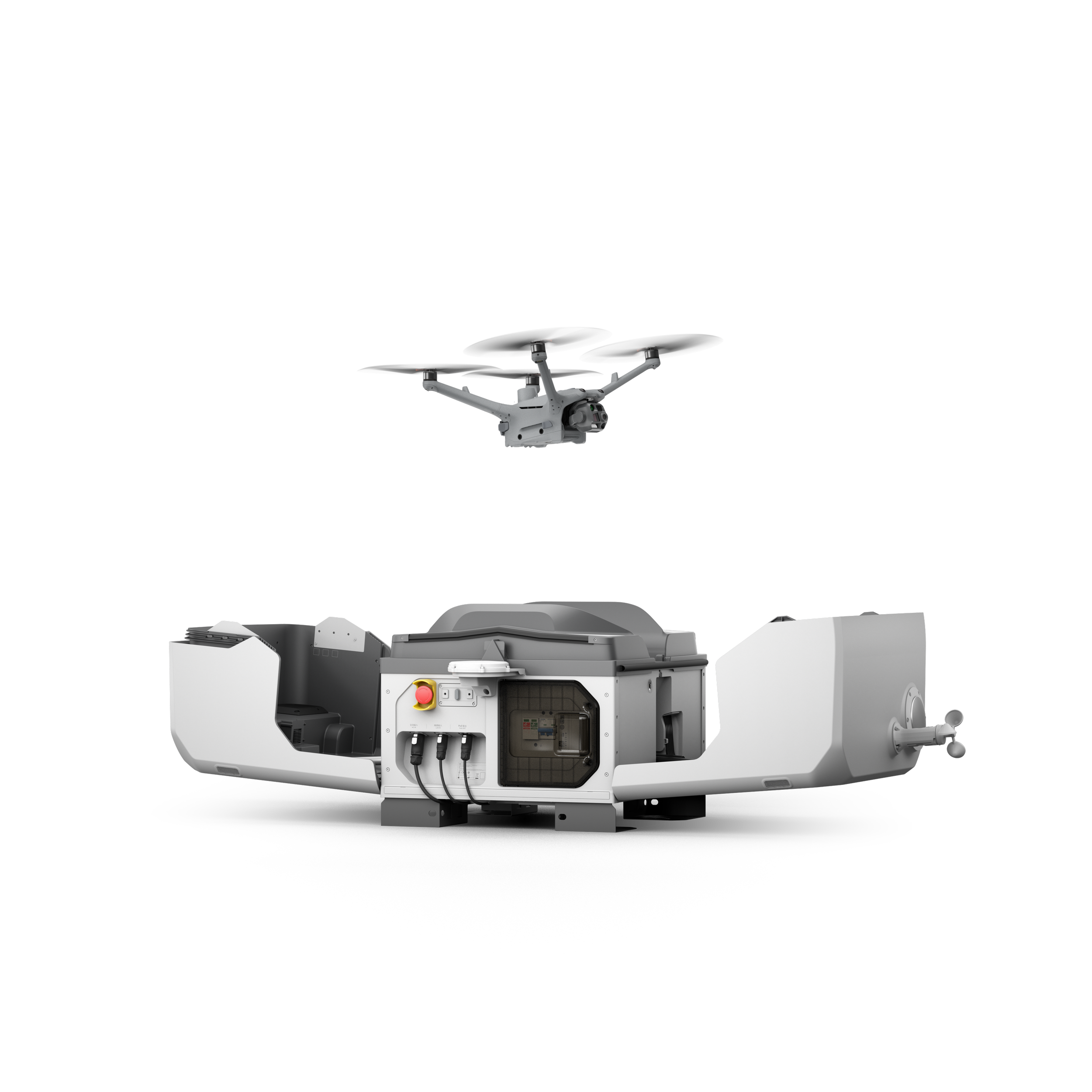
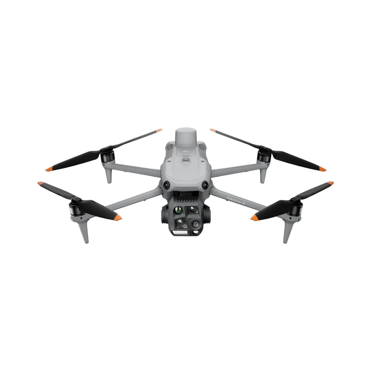
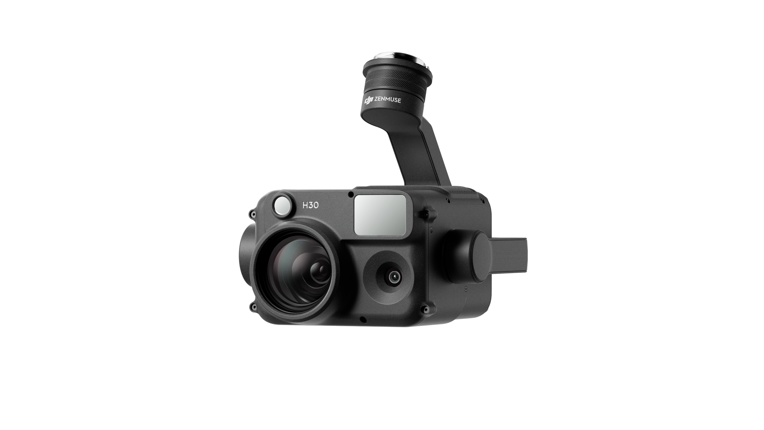
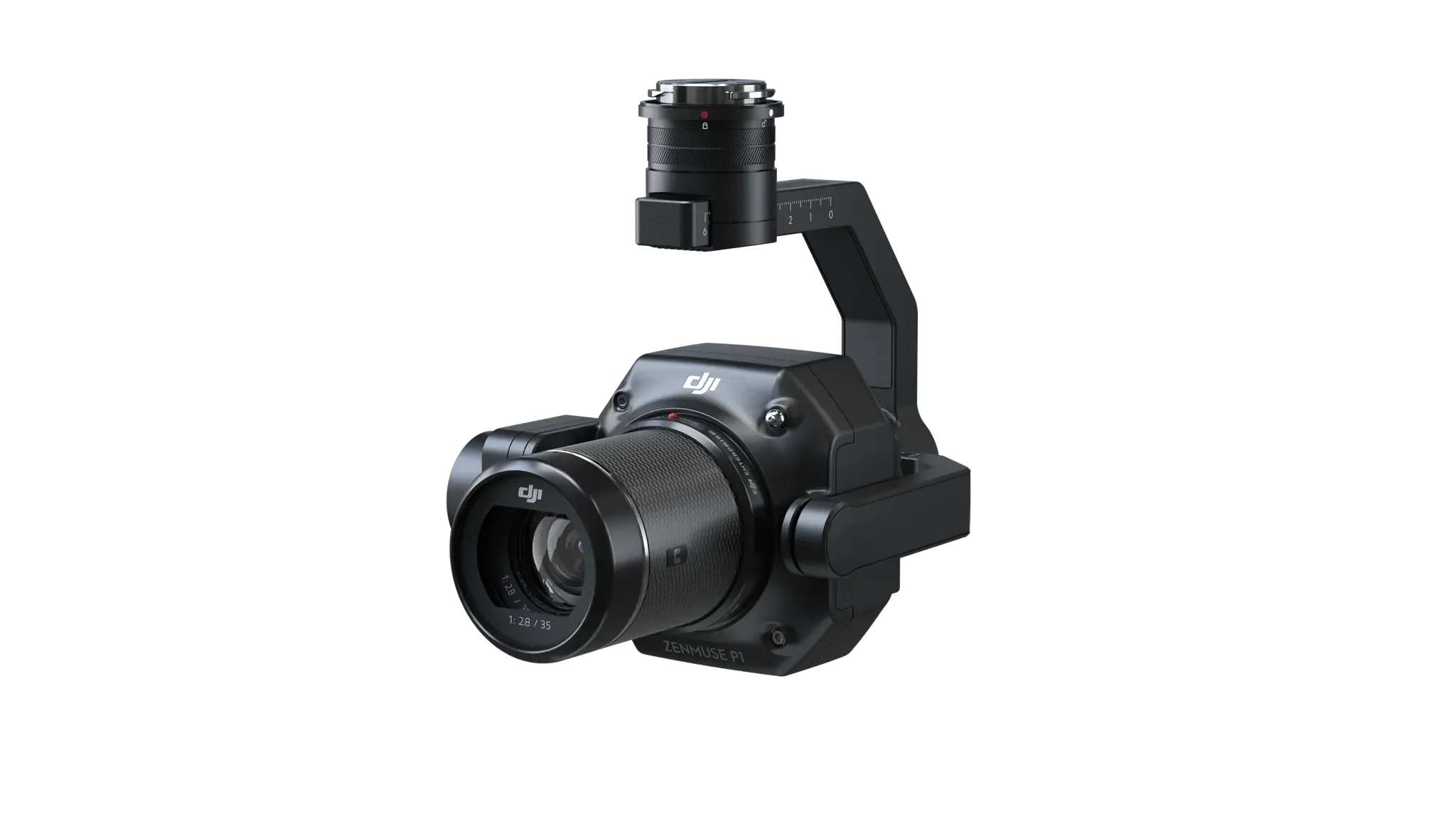
The all-weather, multi-sensor flagship Zenmuse H30 Series integrates five major modules—a wide-angle camera, a zoom camera, an infrared thermal camera, a laser range finder, and an NIR auxiliary light. Employing cutting-edge intelligent algorithms, it revolutionizes perception and imaging standards, transcending the limitations of day and night vision. This makes it effortlessly suitable for a variety of operations, including public safety, energy inspection, water conservation, and forestry.
DJI ZENMUSE H30 SERIES
Stable High-Power AC Output. DJI Power 1000 has a battery capacity of 1024 Wh, providing a max AC output power of 2400 W. It can also fast charge DJI drone batteries to unleash your aerial content creation.
Fast Charges DJI Drones. With the aid of separately-sold charging cables, you can fast charge select DJI drone batteries with the DJI Power SDC super-fast charge function, and be up in the air within approximately 30 mins. With three drone batteries and a DJI portable power station, you can enjoy an entire day of worry-free flight and creation.
Multiple Recharging Options. DJI Power 1000 can be recharged in three ways: grid power, solar power, and car power. Whether indoors or on the road, you can flexibly choose the recharging method that works for you.
DJI POWER 1000
DJI DOCK - EE Group Distributor
DJI Docks are rugged, reliable, and are built to operate 24/7, day or night, rain or shine.
Smaller body, more capable of heavy tasks. The high-performance small unattended platform DJI Dock 2 is equipped with the proprietary Matrice 3D/3TD drone, which is not only lightweight and easy to deploy, but also has stronger operating capabilities and cloud smart functions, significantly reducing the threshold for unattended operations and improving operating efficiency and quality to new heights.
Lightweight design. Compared with the previous generation, the volume and weight of DJI Dock 2 have been reduced by approximately 75% and 68% respectively. It can be carried by two people, greatly improving installation flexibility and reducing installation costs .
Quick site survey. Before deployment, the aircraft can detect the surrounding environment through visual sensors and quickly determine whether the deployment area has good GNSS signals. Compared with the original survey plan, the new visual survey plan significantly speeds up site selection, shortening the required time from 5 hours to less than 12 minutes.
DJI DOCK 2
The DJI Mavic 3E’s extraordinary combination of features enables highly efficient mapping and surveying missions without the need for Ground Control Points.
It integrates a 20 MP wide-angle camera with a 4/3 CMOS sensor with large 3.3μm pixels that, together with Intelligent Low-Light Mode, offer significantly improved performance in dim conditions. Its powerful up-to-56x hybrid zoom camera has an equivalent focal length of 162mm for 12MP images. A mechanical shutter prevents motion blur and supports rapid 0.7-second interval shooting.
Engineered to serve the special needs of aerial operations in firefighting, search and rescue, inspections and night missions, the DJI Mavic 3T has the same tele camera as Mavic 3E, a 48 MP camera with a 1/2” CMOS sensor, as well as a thermal camera with a Display Field of View (DFOV) of 61° and an equivalent focal length of 40mm with 640 × 512 px resolution.
The Mavic 3T's thermal camera supports point and area temperature measurement, high temperature alerts, color palettes, and isotherms to help professionals find hot spots and make quick decisions.
With a simultaneous split-screen zoom, the Mavic 3T's thermal and zoom cameras support 28× continuous side-by-side digital zoom for easy comparisons.
PRODUCT CODE:
DJIM3E1Y / DJIM3E2Y
Experience the forefront of aerial technology with DJI Mavic 3E. Unlock efficiency with its extraordinary feature combination. EEgroup, the leading distributor stands as architects of progress, devoted to guiding both our dealers and suppliers to optimize opportunities within Australia's ever-shifting tapestry of technology. To become a dealer, submit your application by clicking on the button below.
“The Mavic 3 Enterprise also benefits from a shutter speed of 0.7s, compared to the Mavic 3's 2.5s. This shorter shooting interval, coupled with the M3E's 45 minute flight time (or 42 minutes with RTK Module), makes it a highly-efficient surveying solution.”
The new DJI Matrice 30 is DJI Enterprise's flagship drone that fits in a backpack. It integrates multiple high-performance sensors into one single camera payload, is controlled with an ingenious redesigned remote control and runs on upgraded Pilot 2 software, which significantly improves the flight experience. The M30 model offers much more power, endurance and capability for rugged professional uses, while its size makes it ideal for easy transportation and fast setup.
The M30 series comes in two versions, the M30 and the M30T. The M30 model integrates a 48 megapixel 1/2'' CMOS sensor zoom camera with 5×~16× optical and 200× digital zoom, a 12 megapixel wide-angle camera, 8k photo 4K/30 fps video resolution, and a laser rangefinder which can give the precise coordinates of objects up to 1,200 meters away. The M30T features an additional 640x512 px radiometric thermal camera.
PRODUCT CODE:
DJIM30
“More portable than practically any of the company’s other industrial drones — small enough to fit into a large backpack or small rolling case”
Capture accurate details in any mission with the Mavic 2 Enterprise Advanced – a highly versatile yet compact tool that packs a whole lot of performance upgrades. With high-resolution thermal and visual cameras, the M2EA supports up to 32× digital zoom and is capable of centimeter-level positioning accuracy with the RTK module.
Make informed decisions by quickly identifying objects onsite using the M2EA’s integrated high-resolution thermal sensor, which supports Spot Meter and Area Measurement.
The lightweight and portable M2EA can take off in less than a minute. Zip through complex operating environments thanks to the faster ascent and descent speed.
PRODUCT CODE:
DJIM2EA
“Mavic 2 Enterprise Advanced is a ‘game changer’ for public safety.”
The Matrice 300 RTK takes inspiration from modern aviation systems. It offers up to 55 minutes of flight time (with no payloads), advanced AI capabilities, 6 directional sensing and positioning and more. The Matrice 300 sets a new standard, combining intelligence, with high performance and unrivalled reliability.
The all-new OcuSync Enterprise enables transmission up to 15 km away and supports triple-channel3 1080p video. Real-time auto-switching between 2.4 GHz and 5.8 GHz4 enables more reliable flight near high-interference environments, while AES-256 encryption offers secure data transmission.
The refined airframe and propulsion system design gives you a more efficient and stable flight, even in harsh conditions. With a 23m/s max flight speed and 15m/s wind resistance, the Matrice 300 RTK offers unparalleled flying performance, stability and safety.
With multiple payload options, you can configure your M300 RTK to fit your mission needs. Mount up to 3 payloads simultaneously, with a maximum payload capacity of 2.7 kg. This drone is ready for any mission.
PRODUCT CODE:
DJIM300RTK-SET1-STOCK / DJIM300RTK-SET2-STOCK
“With the ability to manage multiple payloads including the new Zenmuse H20 and H20T cameras, the M300 is a rock star of drone technology.”
DJI Dock
DJI Docks are rugged, reliable, and are built to operate 24/7,day or night, rain or shine.
Each DJI Dock houses a Matrice 30 where it lands, recharges, takes off, and executes missions programmed in DJI FlightHub 2.
One DJI Dock weighs less than 105 kg and has a <1 square-meter footprint. Setup only requires ground fixation, access to power and internet, and quick configuration via the DJI RC Plus remote controller.
Fast Charging, Fast Turnaround. Fast charge and take off thanks to TEC air conditioning that cools the drone batteries, enabling charging from 10-90% in just 25 minutes
DJI FlyCart 30
DJI FlyCart 30 is here to deliver the goods. A long-distance heavy lifter with powerful signal and intelligence, DJI FlyCart 30 supports Cargo mode and Winch mode and ascends beyond traditional logistical limits to deliver a safe, economical, and efficient air transport solution.
Send What's Needed, Where It's Needed. Heavy payload capacity and long flight distance overcome logistical limitations fornext-generation delivery.
Strong Signal, Stable Transmission. DJI FlyCart 30 supports DJI O3 video transmission over up to 20 km.Its four-antenna transceiver system intelligently selects the optimal antenna to transmit signals and enhance anti-interference capabilities. Bolster connection and stability with a DJI Cellular Dongle which can work in tandem with DJI O3 video transmission. If O3 video transmission experiences interferrence, the 4G network can maintain signal stability and video transmission, improving flight safety even in complex environments.
Upgrade your next mapping mission with the Phantom 4 RTK – the most compact and accurate low altitude mapping solution.
DJI has rethought its drone technology from the ground-up, revolutionizing its systems to achieve a new standard for drone accuracy – offering Phantom 4 RTK customers centimeter-accurate data while requiring fewer ground control points.
A new RTK module is integrated directly into the Phantom 4 RTK, providing real-time, centimeter-level positioning data for improved absolute accuracy on image metadata. In addition to optimized flight safety and precise data collection, the Phantom 4 RTK stores satellite observation data to be used for Post Processed Kinematics (PPK), which can be conducted using DJI Cloud PPK Service*. Fit the Phantom 4 RTK to any workflow, with the ability to connect this positioning system to the D-RTK 2 High Precision GNSS Mobile Station, or NTRIP (Network Transport of RTCM via Internet Protocol) using a 4G dongle or WiFi hotspot.
Capture the best image data with a 1-inch, 20-megapixel CMOS sensor. Mechanical shutter makes mapping missions or regular data capture seamless as the Phantom 4 RTK can move while taking pictures without the risk of rolling shutter blur. Due to the high resolution, the Phantom 4 RTK can achieve a ground sample distance (GSD) of 2.74 cm at 100 meters flight altitude.To ensure each Phantom 4 RTK offers unparalleled accuracy, every single camera lens goes through a rigorous calibration process, with parameters saved into each image’s metadata, letting post-processing software adjust uniquely for every user.
PRODUCT CODE:
DJIPHANTOM4RTKCOM-STOCK
“This product marks a major investment by DJI in the future of aerial mapping,”
Gather precise plant-level data using the P4 Multispectral – a high-precision drone with a seamlessly integrated multispectral imaging system built for agriculture missions, environmental monitoring, and more.
The P4 Multispectral consolidates the process of capturing data that gives insight into crop health and vegetation management. DJI has created this platform with the same powerful performance standards that DJI is known for, including 27 minutes max flight time and up to 7 km1 transmission range with the OcuSync system.
Agriculture imagery collection is now simpler and more efficient than ever before with a built-in stabilized imaging system that collects comprehensive data sets right out of the box. Access information collected by 1 RGB camera and a multispectral camera array with 5 cameras covering Blue, Green, Red, Red Edge, and Near Infrared bands – all at 2 MP with global shutter, on a 3-axis stabilized gimbal.
PRODUCT CODE:
DJIP4MSCOM / DJIP4MSRTKCOM-STOCK
“It's the first drone that has an integrated multispectral camera within the drone. It's RTK, so it’s higher precision.”
The Inspire 1 was a revelation. The first filmmaking drone in the world to integrate an HD video transmission system, 360° rotating gimbal and a 4K camera,as well as the simplicity of app control.
The launches of the Zenmuse X5 and X5R cameras further cemented the Inspire as a critical tool for filmmakers around the globe.
The Inspire 2 takes everything that was good about the Inspire 1 and improves it. The image processing system CineCore2.0 has been upgraded to CineCore2.1,recording video at up to 6K in CinemaDNG/RAW and 5.2K in Apple ProRes when used with Zenmuse X7 camera. It goes from 0 to 50 mph (80 kph) in just 5 seconds andhits a maximum speed of 58 mph (94 kph) and has a max descent speed of 9m/s for unheard of speed and agility in an aircraft this size. A dual battery systemprolongs the flight time to a maximum of 27 minutes (with an X4S), while self-heating technology allows it to fly even in low temperatures.
FlightAutonomy has been revised and developed specifically for the Inspire 2, providing two directions of obstacle avoidance and sensor redundancy.Increased intelligence adds multiple intelligent flight modes, including Spotlight Pro, giving even single pilots the ability to create complex, dramatic shots.An upgraded video transmission system is now capable of dual signal frequency and dual channel, streaming video from an onboard FPVcamera and the main camera simultaneously, for better pilot and camera operator collaboration.
PRODUCT CODE:
DJINSPIRE2
“The Inspire 2 is sure to be the darling drone of pro filmmakers.”
DJI AGRAS T50
DJI AGRAS T50 elevates drone agricultural operations to new heights. It inherits a powerful coaxial twin-rotor propulsion system and a split-type torque resistant structure for next level stability when carrying 40 kg spraying or 50 kg spreading payloads.
DJI AGRAS T50 leverages a Dual Atomizing Spraying System, Front and Rear Phased Array Radars, and a Binocular Vision System. DJI AGRAS T50 excels across multiple scenarios, from surveying to spraying and spreading, guaranteeing stable operations and steady performance.
DJI AGRAS T25
DJI AGRAS T25 redefines standards for compact agricultural drones. Light and nimble, DJI AGRAS T25 can easily be handled by one person. It can carry a spraying payload up to 20 kg or a spreading payload up to 25 kg. DJI AGRAS T25 is equipped with Front and Rear Phased Array Radars, a Binocular Vision System, and a high resolution FPV gimbal camera. DJI AGRAS T25 supports multiple missions, from surveying to spraying and spreading and excels across a variety of terrains.
The DJI Agras T10 brings a highly compact-yet-powerful aerial solution to agriculture sites of all sizes and needs. An 8 liter tank and spray width of up to 5 meters allow the aircraft to cover up to 15 acres/hour.
Its folding truss structure is sturdy and reliable, enabling efficient folding and unfolding, convenient transportation, and easy transitions.
A carbon fibre composite body keeps the Agras T10 both lightweight and strong. It can also fold down by 70% for more convenient transportation. The battery and tank can be quickly attached and detached to make refilling more efficient.
The aircraft takes off with the push of a button. Autonomous planning and automatic edge sweeping offer extensive spray coverage and effortless operation.
The T10 also comes standard with an RTK module with centimetre-precision positioning.
The new DJI Agriculture app enables a smoother system experience and more intuitive operation.
PRODUCT CODE:
DJIAG-T10SET1-STOCK
“The Agras T10 comes with an 8-liter spray tank. A spray width of up to 5 meters allows this drone to cover up to 15 acres an hour.”
With a 30 liter spraying tank, the DJI Agras T30 takes aerial spraying efficiency to new heights. A revolutionary transforming body enables more effective spraying, especially for fruit trees. Using DJI digital agriculture solutions, the T30 helps reduce fertilizer use and increase yield with effective, data-driven best practices.
With revolutionary branch-targeting technology and adjustable arms, the Agras T30 penetrates thick canopies with oblique spraying, ensuring an even application of liquid pesticides and doubling the number of droplets. [1] With the help of the Smart Agriculture Cloud Platform and cloud-based mapping, users can manage a 3D digital orchard, making it easy to get started with digital agriculture.
16 spray nozzles provide extensive coverage
with even distribution, strong penetration, and exceptional drift prevention.
The spherical radar system perceives obstacles and surroundings in all environments, weather conditions, and viewing angles, regardless of dust and light interference. Automatic obstacle avoidance and adaptive flight functions help ensure safety during operation.
PRODUCT CODE:
DJIAG-T30SET1-STOCK
“When used with DJI digital agriculture solutions, the T30 can implement variable spreading, reducing fertilizer use while increasing yield.”
The AGRAS T40 is equipped with the revolutionary Coaxial Twin Rotor design, enabling it to carry a spray load of 40 kg[1]and a spread load of 50 kg (70 L)[1]. The aircraft is built in with a Dual Atomized Spraying System, DJI Terra, Active Phased array Radar and Binocular Vision. It supports multiple missions from surveying, mapping, to spraying and spreading, helping you achieve ultimate precision in your agricultural operations.
PRODUCT CODE:
DJIAG-T40SET1-STOCK
Accessories
We stock a range of accessories for the DJI enterprise and Agras range that improve your flying experience, extend the useable flight time and help to protect your drone.
EE Group - 100% Authorised Distributor of DJI in Australia
EE Group proudly holds the title of the 100% Authorized DJI distributor in Australia, solidifying our commitment to providing customers with direct access to the latest advancements in drone technology.
As your reliable distributor, we offer a complete range of DJI innovations, ensuring you have the tools to elevate your aerial photography and videography. Whether you're seeking the latest innovations or require assistance with DJI repair, trust EE Group to meet your aerial photography and videography needs seamlessly.
Explore our selection and benefit from the assurance of genuine DJI products, supported by the expertise and dedication of EE Group.